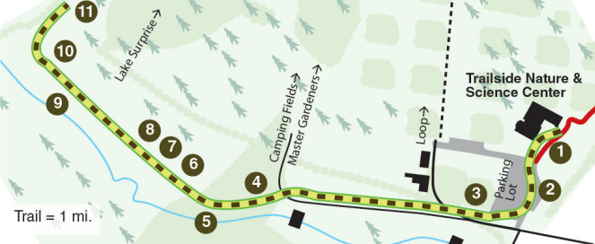
|
|
STOP
1 |
Trailside
Nature &
Science Center |
|
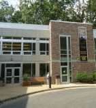 The
self-guided hike begins on the lower level of the Nature Center, to
provide you with an overview of what you will see on the trail, and
a graphic history of the area. Please take time to view the exhibits
of basalt minerals and fluorescent minerals (in the Discovery Room)
as well. When you leave the Visitor Center, turn right and walk
to the highest edge of the parking lot to the marked outcrop. The
self-guided hike begins on the lower level of the Nature Center, to
provide you with an overview of what you will see on the trail, and
a graphic history of the area. Please take time to view the exhibits
of basalt minerals and fluorescent minerals (in the Discovery Room)
as well. When you leave the Visitor Center, turn right and walk
to the highest edge of the parking lot to the marked outcrop. |
 |
|
STOP
2 |
Basalt
Outcrop |
|
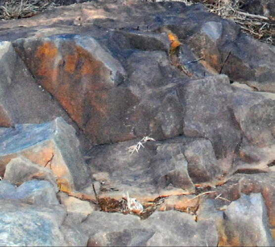
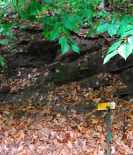
 In
the parking lot, you are standing on the ridge of the First Watchung
Mountain, formed by the first, and oldest, lava flow 210 million
years ago. Look down the hill, behind the trees, toward the west to
see the second ridge. The low area in between the ridges formed as
the softer sandstones and shales eroded more rapidly. The marked
outcrop is basalt, which formed the step-like structure as the lava
cooled. Basalt is also called trap rock, from the Scandinavian word
“treppe” which means stair. The chemical weathering and
oxidation of
the iron-rich basalt produces its rusty color. Many
trap rock
quarries are located in the Watchung Mountains. The rock is blasted
from the quarry walls and crushed to produce gravel for road stone
and asphalt. Cross the parking lot and continue to the street
entrance. Turn right and walk downhill on the paved road, as far as
the lower edge of the parking lot. In
the parking lot, you are standing on the ridge of the First Watchung
Mountain, formed by the first, and oldest, lava flow 210 million
years ago. Look down the hill, behind the trees, toward the west to
see the second ridge. The low area in between the ridges formed as
the softer sandstones and shales eroded more rapidly. The marked
outcrop is basalt, which formed the step-like structure as the lava
cooled. Basalt is also called trap rock, from the Scandinavian word
“treppe” which means stair. The chemical weathering and
oxidation of
the iron-rich basalt produces its rusty color. Many
trap rock
quarries are located in the Watchung Mountains. The rock is blasted
from the quarry walls and crushed to produce gravel for road stone
and asphalt. Cross the parking lot and continue to the street
entrance. Turn right and walk downhill on the paved road, as far as
the lower edge of the parking lot. |
|
|
|
STOP
3 |
Erosion at
Parking Lot |
|
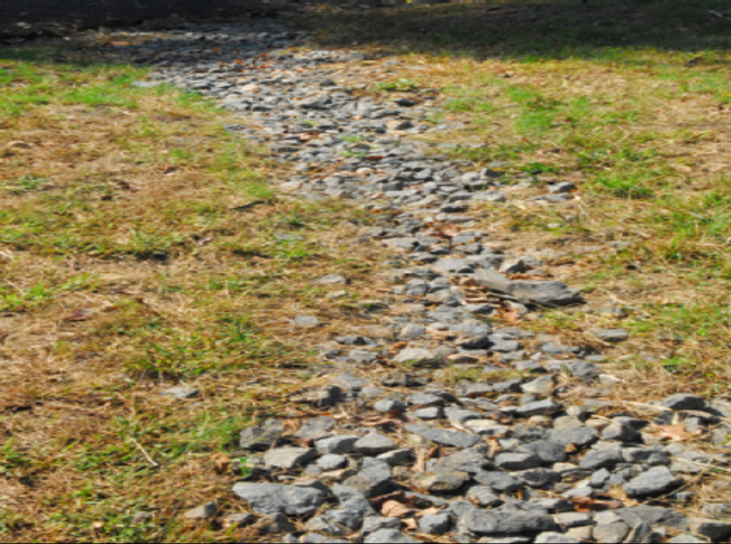
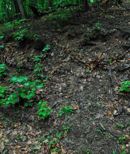
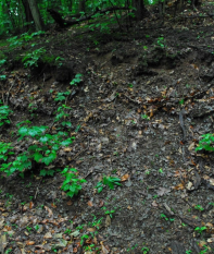
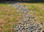 When rain
falls on vegetated areas, most of it is absorbed by the plants and
soil. When it falls on an impermeable surface such as this paved
parking area, it cannot be absorbed and flows over the surface. The
cumulative effect of this surface runoff can be seen at the low
corner of the parking area, where the soil washed away and created a
gully, which is now filled with gray gravel. Extensive paving in New
Jersey — for parking lots, malls, and business parks — has led to
increased runoff, erosion and flooding. The orange
basalt fragments
you see are highly oxidized due to abundant moisture, giving the
fragments, and the soil derived from them, a typically “rusty”
color. The gray gravel, recently emplaced, has not yet oxidized.
Continue down the paved road to the Orange Trail entrance. When rain
falls on vegetated areas, most of it is absorbed by the plants and
soil. When it falls on an impermeable surface such as this paved
parking area, it cannot be absorbed and flows over the surface. The
cumulative effect of this surface runoff can be seen at the low
corner of the parking area, where the soil washed away and created a
gully, which is now filled with gray gravel. Extensive paving in New
Jersey — for parking lots, malls, and business parks — has led to
increased runoff, erosion and flooding. The orange
basalt fragments
you see are highly oxidized due to abundant moisture, giving the
fragments, and the soil derived from them, a typically “rusty”
color. The gray gravel, recently emplaced, has not yet oxidized.
Continue down the paved road to the Orange Trail entrance. |
|
|
|
STOP
4 |
Carriage Road
|
|
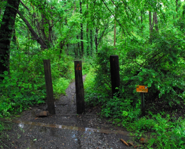
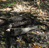
 Follow the
Orange Trail past the steps made of logs and rocks installed by
volunteers to slow erosion of the trail. The trail was once an old
carriage roadway, which led to a mill town called Feltville, now the
Deserted Village. As you proceed down the trail, you will notice the
banks on each side are steep. Each time a hiker walks down the
trail, a little soil is loosened. When it rains, the loosened soil
is washed down hill. At one time, the narrow valley you are walking
did not exist. Much of the soil and rock has been transported by
erosion, washed away by rainwater flowing down the slope.
Continue down trail. Follow the
Orange Trail past the steps made of logs and rocks installed by
volunteers to slow erosion of the trail. The trail was once an old
carriage roadway, which led to a mill town called Feltville, now the
Deserted Village. As you proceed down the trail, you will notice the
banks on each side are steep. Each time a hiker walks down the
trail, a little soil is loosened. When it rains, the loosened soil
is washed down hill. At one time, the narrow valley you are walking
did not exist. Much of the soil and rock has been transported by
erosion, washed away by rainwater flowing down the slope.
Continue down trail. |
|
|
|
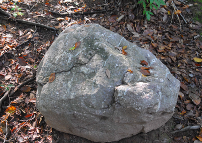
STOP
5 |
Puddingstone Boulder |
|
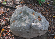 This huge purple
boulder with white pebbles is an example of a glacial erratic. It
was not formed in the Watchung Mountains, but carried by a
glacier
and dropped here less than one million years ago. It is a
conglomerate of white quartz pebbles and purple
quartzite in a
purple hematite-stained
matrix. The rock originated in the Green
Pond area of Morris and Sussex counties, over 25 miles to the
northwest. It is known as Green Pond
Conglomerate or “puddingstone”.
Continue down the slope until you are standing on a bumpy gray
rock surface in the middle of the trail. This huge purple
boulder with white pebbles is an example of a glacial erratic. It
was not formed in the Watchung Mountains, but carried by a
glacier
and dropped here less than one million years ago. It is a
conglomerate of white quartz pebbles and purple
quartzite in a
purple hematite-stained
matrix. The rock originated in the Green
Pond area of Morris and Sussex counties, over 25 miles to the
northwest. It is known as Green Pond
Conglomerate or “puddingstone”.
Continue down the slope until you are standing on a bumpy gray
rock surface in the middle of the trail. |
|
|
|
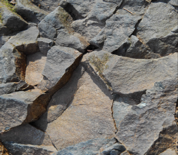
STOP
6 |
Surface of
Lava Flow |
|
 You are standing
on the top of one of the lava flows that make up the First Watchung
Mountain. This is the top surface of a series of
basalt columns
formed when the lava contracted as it cooled and hardened.
Continue down the hill. You are standing
on the top of one of the lava flows that make up the First Watchung
Mountain. This is the top surface of a series of
basalt columns
formed when the lava contracted as it cooled and hardened.
Continue down the hill. |
|
|
|
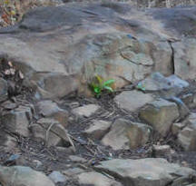
STOP
7 |
Glacial
Erratic |
|
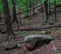 These
boulders are glacial erratics, too. The term “glacial
erratic” refers to any rock that was frozen into glacial ice
and carried with it on its southward journey. Continue
down the slope a short distance. These
boulders are glacial erratics, too. The term “glacial
erratic” refers to any rock that was frozen into glacial ice
and carried with it on its southward journey. Continue
down the slope a short distance. |
|
|
|
STOP
8 |
Hillside
Spring
|
|
 This muddy spot
is where the water from a hillside spring emerges at the surface and
flows down the trail. There is a great supply of water stored below
the surface of the Watchung Reservation. Native Americans used these
springs, and today our local water company has wells that tap this
water supply for our homes.
Continue down the hill, which becomes
the Blue Trail.
Do not follow the Orange trail. Just ahead
look at the stream to your left. This muddy spot
is where the water from a hillside spring emerges at the surface and
flows down the trail. There is a great supply of water stored below
the surface of the Watchung Reservation. Native Americans used these
springs, and today our local water company has wells that tap this
water supply for our homes.
Continue down the hill, which becomes
the Blue Trail.
Do not follow the Orange trail. Just ahead
look at the stream to your left. |
|
|
|
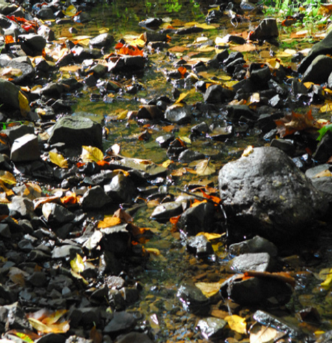
STOP
9 |
Stream |
|
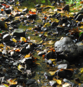 Streams do not
flow in straight lines, but form and follow gentle curves called
meanders. Water flows faster on the outside bend of the meander,
eroding the stream bank there more quickly. The faster water moves,
the more sediment it can carry, transporting particles of all sizes
downstream. Continue on the Blue Trail. Look at the hill to the
right. Streams do not
flow in straight lines, but form and follow gentle curves called
meanders. Water flows faster on the outside bend of the meander,
eroding the stream bank there more quickly. The faster water moves,
the more sediment it can carry, transporting particles of all sizes
downstream. Continue on the Blue Trail. Look at the hill to the
right. |
|
|
|
STOP
10 |
Red
Sandstone & Red
Shale |
|
 These are
sedimentary rocks. The shale is composed of thinly-layered lithified
mud that breaks easily into sheets. The sparkly surfaces are caused
by bits of mica deposited with the mud. Intermixed with the shale
are blockier layers of red sandstones. The shales and
sandstones
were deposited by streams along the edges of shallow lakes where
seasonal drying occurred, and their red color is due to the chemical
reaction of atmospheric oxygen with the iron in the rock. These
rocks, in layers called beds, are tipped slightly to the northwest.
Most of the rocks in the Newark Basin dip in this direction at an
angle of about 15 degrees. This tilt is due to the movement of the
Earth’s crust as the continental plates drifted apart during
Jurassic time, forming the Atlantic Ocean. Continue down the hill
and turn right on the bridle trail (an unmarked, wider trail). Do
not stay on the Blue Trail. These are
sedimentary rocks. The shale is composed of thinly-layered lithified
mud that breaks easily into sheets. The sparkly surfaces are caused
by bits of mica deposited with the mud. Intermixed with the shale
are blockier layers of red sandstones. The shales and
sandstones
were deposited by streams along the edges of shallow lakes where
seasonal drying occurred, and their red color is due to the chemical
reaction of atmospheric oxygen with the iron in the rock. These
rocks, in layers called beds, are tipped slightly to the northwest.
Most of the rocks in the Newark Basin dip in this direction at an
angle of about 15 degrees. This tilt is due to the movement of the
Earth’s crust as the continental plates drifted apart during
Jurassic time, forming the Atlantic Ocean. Continue down the hill
and turn right on the bridle trail (an unmarked, wider trail). Do
not stay on the Blue Trail. |
|
|
|
STOP
11 |
Gray Shale |
|
 (As you walk up
the trail, notice many of the smaller trees with the lower portion
of their trunks curved in a downhill direction. This is evidence of
a form of erosion called soil “creep.” Under the influence of
gravity, the soil on steep hillsides moves slowly downhill. As the
trees grow, they constantly adjust their growth direction to remain
upright.) At this stop, the thin papery pieces of shale are gray.
This color indicates that these sediments were continuously covered
with water, probably in a deeper part of a lake or swamp. The red
and gray shales are part of a larger unit called the Feltville
Formation. This formation is approximately 600 feet thick and
overlies the basalt of the Orange Mountain Formation that forms the
First Watchung Mountain. The Feltville Formation is, in turn,
covered by another flow of lava known as the Preakness
Basalt. This
forms the Second Watchung Mountain, which rises on the other side of
the swampy area. (As you walk up
the trail, notice many of the smaller trees with the lower portion
of their trunks curved in a downhill direction. This is evidence of
a form of erosion called soil “creep.” Under the influence of
gravity, the soil on steep hillsides moves slowly downhill. As the
trees grow, they constantly adjust their growth direction to remain
upright.) At this stop, the thin papery pieces of shale are gray.
This color indicates that these sediments were continuously covered
with water, probably in a deeper part of a lake or swamp. The red
and gray shales are part of a larger unit called the Feltville
Formation. This formation is approximately 600 feet thick and
overlies the basalt of the Orange Mountain Formation that forms the
First Watchung Mountain. The Feltville Formation is, in turn,
covered by another flow of lava known as the Preakness
Basalt. This
forms the Second Watchung Mountain, which rises on the other side of
the swampy area.
This
concludes the geology hike. You may turn around and walk back up the
Orange Trail to the parking lot or you may continue up the bridle
path, and bear right, which will take you to The Loop picnic area.
Map of Watchung Reservation.
Interested in
another informative trail? Go
to the Watchung Reservation History Trail. |
|
|
|